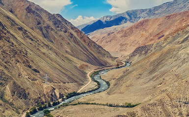
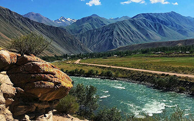
The Suusamyr valley is an elongated, roughly triangular, high mountain valley in Kyrgyzstan running from west to east between the mountain ranges of the Kyrgyz Alatau in the north, the Suusamyrtoo in the south and south-west and the Jumgaltoo in the south-east; all three are part of the Tienshan mountain system. The valley, which is more than 4000 km² in size, extends for about 100 km in length and up to 40 km in width at an altitude of 2000 to 2500 m above sea level and is traversed by the eponymous river Suusamyr in a generally west-east direction. In the eastern part of the valley, the Karakol (also "Western Karakol") runs along its southern flank for about 30 km, which then unites with the Suusamyr at Koshomkul and thus forms the Kökömeren, which leaves the valley to the south.
The valley lies in the southwest of the Chuy Region; a small part to the east belongs administratively to the Naryn area. The most important and largest place in the valley is Suusamyr. There is national road from Bishkek to Osh runs through the valley; it reaches it in the north after passing the 2.7 km long tunnel at the Töö pass or its south portal located at 3180 m altitude and leaves it in the northwest via the 3184 m high Alabel pass into the Talas area. In the far north-west of the valley, the EM-14 (ex-Soviet A361) branching off from the EM-02 also leads over the 3300 m high Ötmök Pass into the Talas area.
The Suusamyr Valley has a distinct continental climate, with long and snowy winters. The average July temperatures in the valley are between 13 and 14 ° C, the average January temperatures between −20 and −21 ° C. The annual rainfall is 350 to 370 mm and consists mainly of powder snow, which covers the area almost six months a year with a thickness of up to 1 m.
After the snowmelt, the valley offers a colourful sight of blooming herbs and wildflowers and from May to October, it is used as summer pasture by shepherds with their large herds of sheep and horses from large parts of Kyrgyzstan.


