Kok Gumbaz
Ajina Teppa
Ancient Panjakent
Anzob Tunnel
Beshkent Qala
Childukhtaron
Khazrati Shokh
Mug Teppa
Gharm Chashma
Hisor Historical
Haji Yaqub mosque
Hazrati-Bobo complex
Lake Iskanderkul
Kalai-Khumb
Karatag
Karon
Khishtin caravanserai
Khorog
Khulbuk
Lake Karakul
Abdullatif Sultan
Madrasai Kuhna
Abu Abdullah Rudaki
Khoja Mashhad
Khudoyor Valami
Makhmudi Azam
Mir Sayyid Ali Hamadani
Muhammed Bashoro
Sheikh Muslihiddin
Nurek Mountain Lake
Pamir
Sarazm
Sari-Khosor
Seven Lakes
Shirkent
Chiluchorchashma
Takht-i Sangin
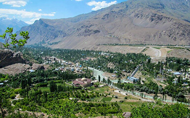
Khorog

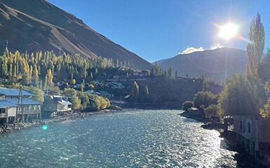
Khorog is a city located on the territory of the Republic of Tajikistan, the administrative centre of the Gorno-Badakhshan Autonomous Region. It is also the first city from which the journey along the Great Pamir Highway begins. Khorog received the status of the city only in 1932. It is located at the bottom of a deep gorge at an altitude of 2200 meters, not far from the confluence of the Gunt River with the Pyanj, 525 kilometers from the capital of the republic - the city of Dushanbe. Due to its location in a deep canyon, the city is protected from strong winds and cold temperatures in winter; summers are usually warm and dry here.
Mayakovsky peak rises above Khorog in the Ishkashim ridge, its height is 6096 meters.
Highways with Dushanbe and Osh connect the city. There is also a small airport, whose “inhabitants” are small-sized propeller-driven aircraft that make regular flights to Dushanbe and other cities of the republic several times a week. The airport in Khorog is the only regular airport in the entire Gorno-Badakhshan Autonomous Region.
The population of this small settlement in 2003 was 30 thousand people. According to the ethnic composition, the population here is made up of Pamir Tajiks, who profess a religion called Ismailism.
The archaeological complex Kofir-Kala is located 30 km from Khorog on a high rocky cliff, in the village of Bogev, consisting of a fortress with a citadel and the remains of two round temples with a radius of 11 and 9 meters. Both temples had stone sufas along the walls, hearths and stone obelisks in the middle. Perhaps the temples were covered with wooden stepped ceilings with a skylight at the zenith. In combination with fortress walls and towers, temples constituted in antiquity and the Middle Ages a well-fortified social and cult centre of Shugnan, associated with sun worship. The tradition of erecting round structures in terms of plan and associated solar symbolism was mainly characteristic of the Saka burial grounds of the Eastern Pamirs.
47 kilometres from Khorog above the village of Kukhilal, the mountain of the same name rises - the deposit of the famous Badakhshan "lal" - noble spinel, also known as "Badakhshan lal" and mentioned in Khudud-al-Alam (982), the book "Mineralogy" by al Biruni and in the book by Marco Polo (13th century), who wrote that local residents "dig in Mount Shighinan (Shugnan) and extract balashi (rubies) there on the tsar's order." During research in Mount Kuhilal, about 500 ancient workings of the 8th - 11th centuries were discovered.

